In the field
Open a point, see the picture, start navigating.
Each point opens with the note left by the surveyor who established it, the photo taken at the time, and a navigation action that hands the coordinates to the phone. No more calling the office to ask where the benchmark was.
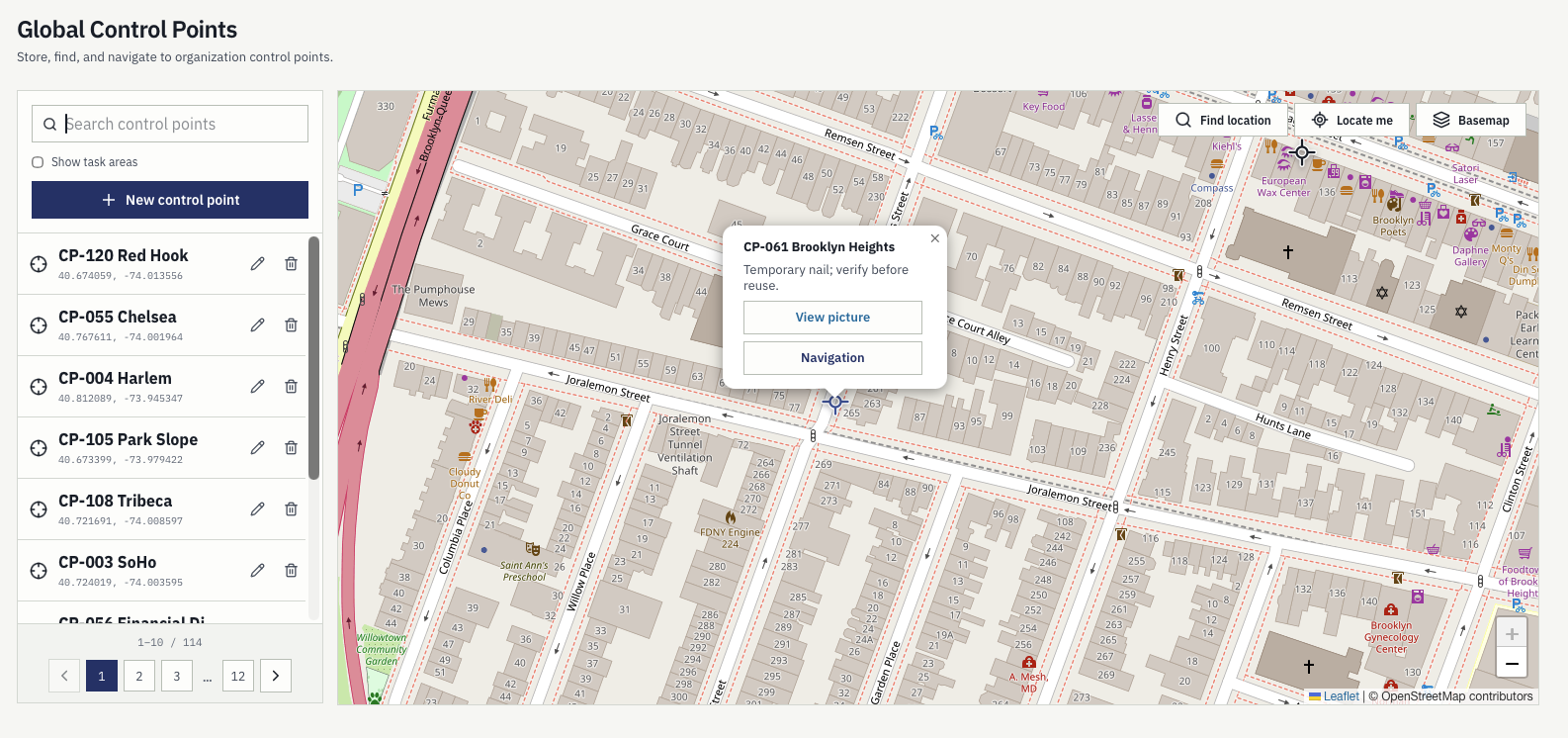
Point detail
The note and the photo travel with the point.
A point set two years ago is still usable by whoever is nearest today, because the context that made it usable was stored with it rather than remembered by one person.
- Photograph taken when the point was established
- Condition note explaining how it was set
- Coordinates ready to hand to a device
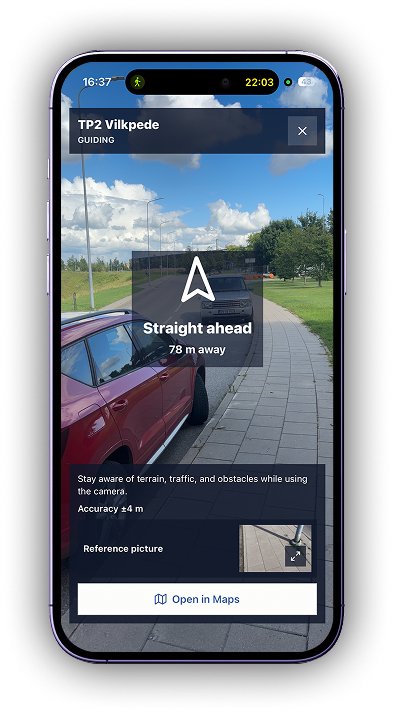
Camera guide
Bearing, remaining distance, and accuracy on the walk in.
The camera guide shows a live view with the direction to the mark, how far is left, and the current position accuracy, for the stretch where coordinates alone stop helping.
- Live camera view with bearing to the point
- Remaining distance as the crew walks in
- Current position accuracy shown continuously
Task geometry
The shape of the job is part of the job.
A task is not only an address. When it is created it can carry a point, a line, or a polygon — the mark to set, the traverse to run, the parcel to pick up — and that geometry stays on the task for whoever picks it up.
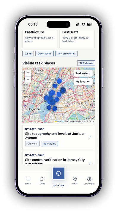
Task places
Every open task on one map.
Crews see what is around them rather than what is on a list. Tasks near the current position are flagged, and the map shows the extent of the work rather than a single dropped pin.
- Point, line, or polygon drafted on the task
- Open tasks shown as places on the map
- Nearby tasks flagged against the current position
Getting there
Hand it to the phone, then walk it in.
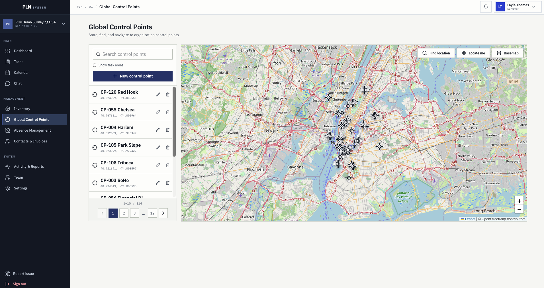
For the drive, the coordinates go to Waze or Google Maps like any other destination. For the last stretch, where a road app stops being useful, the camera guide — an augmented-reality view through the phone camera — shows the bearing, the distance left, and the current position accuracy. Control points live on the same map and are found the same way, with their note, photograph, and coordinates readable from the point itself.
- Coordinates handed to Waze or Google Maps
- Camera guide for the final approach on foot
- Control points and task geometry on one map